Partners
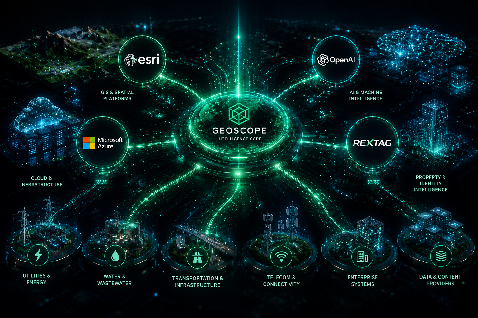
Esri ecosystem strength and infrastructure data advantage.
GeoScope combines Esri Startup Network access with premium infrastructure data partnerships to build practical, scalable location intelligence solutions.

Esri
Partner Network / Startup Network
ArcGIS ecosystem access for enterprise GIS, dashboards, field tools, APIs, and scalable location intelligence.
Rextag
Data Partnership
Rextag
Data Partnership
Fiber, energy, utility, and pipeline context for infrastructure-aware SiteIQ workflows.
Esri Startup Network
Advancing innovation with the power of location.
GeoScope is proud to be a member of the Esri Startup Network, which provides access to world-class technology, expertise, learning resources, and a global ecosystem.
This relationship helps GeoScope build innovative geospatial solutions that solve real-world problems and create measurable impact.
Esri ecosystem
ArcGIS platform, APIs, dashboards, field tools, and enterprise GIS delivery.
GeoScope
Rextag data
Fiber, energy, utility, pipeline, and corridor context for infrastructure-aware workflows.
SiteIQ workflows
Screen sites, analyze infrastructure constraints, score opportunities, and export decision-ready reports.
Partner ecosystem
Technology, data, and workflows for enterprise location intelligence.
GeoScope's partner story connects Esri-enabled platform delivery with infrastructure-aware SiteIQ intelligence.
Esri Startup Network
GeoScope is a member of the Esri Startup Network, using ArcGIS technology, resources, and community connections to build innovative location intelligence solutions.
Rextag data partnership
Rextag fiber and energy infrastructure data strengthens infrastructure-aware site selection, corridor analysis, and utility context inside SiteIQ workflows.
Infrastructure workflows
GeoScope translates partner-backed technology and data into practical workflows for planning, expansion, diligence, and executive reporting.
How Esri empowers GeoScope
Access, learning, community, go-to-market support, and scale.
Built on the ArcGIS platform, GeoScope can support cloud maps, enterprise GIS, professional desktop analysis, APIs, dashboards, field collection, insights, and stakeholder engagement.
Technology access
Leverage ArcGIS platform and cloud capabilities to build impactful location intelligence solutions.
Learn and grow
Use technical resources, training, and best practices to accelerate innovation and delivery.
Network and collaborate
Connect with a global community of startups, partners, and Esri experts.
Go-to-market support
Benefit from business development support, visibility, and opportunities to showcase solutions.
Scale and impact
Scale location intelligence solutions that create value for customers and communities.
Rextag partnership
Infrastructure intelligence as a premium SiteIQ workflow advantage.
Rextag fiber and energy infrastructure data adds critical context for organizations evaluating sites, corridors, utilities, and infrastructure investment.
Fiber infrastructure intelligence
Add fiber route and network context to market, corridor, and site evaluation workflows.
Energy infrastructure data
Use energy infrastructure context to strengthen feasibility, risk, and investment analysis.
Utility and pipeline context
Understand utility, pipeline, and corridor proximity when evaluating infrastructure-sensitive sites.
Infrastructure-aware site selection
Bring Rextag-backed infrastructure signals into SiteIQ suitability, risk, and proximity decisions.
Premium SiteIQ data add-on
Position Rextag layers as a premium data enhancement for advanced SiteIQ workflows.
Stronger together through location intelligence.
Use GeoScope's Esri ecosystem alignment and infrastructure data advantage to build smarter, more sustainable spatial workflows.